Welcome to lower Winthrop Street, section 39, the pedestrian‘s portal to East New London via the Central Vermont Railway footbridge.
As we learned from visiting the Hallam Street crossing, the residents living in Winthrop‘s Neck are called Neckers.
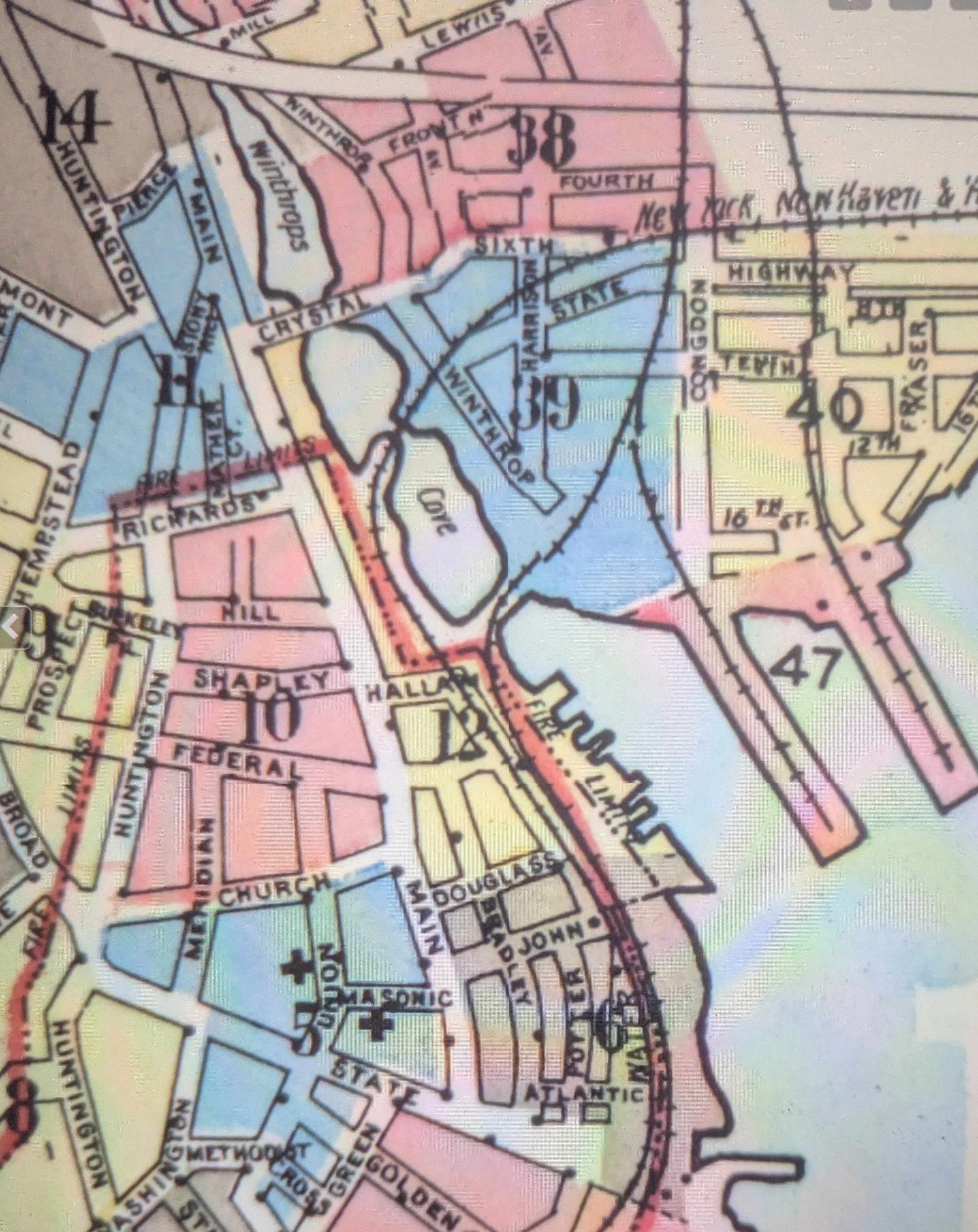
We are going to first look at the west side which sort of resembles a harp on the left side of the Central Vermont freight yard. The State Pier is on the right side of the tracks.In the lower left corner is the footbridge to Hallam Street.
As a boy or girl living on Winthrop, Harrison or Tenth Streets encircled by railroad tracks and the water, it was hard not to be influenced by boats and trains.
If you look in the upper left hand corner, you‘ll see the bend northwards in Crystal Avenue. That bend, now more of a curve, is still there. And you can still hang a right just before that curve, pass under the tracks, and bear right to stay on Winthrop Street.
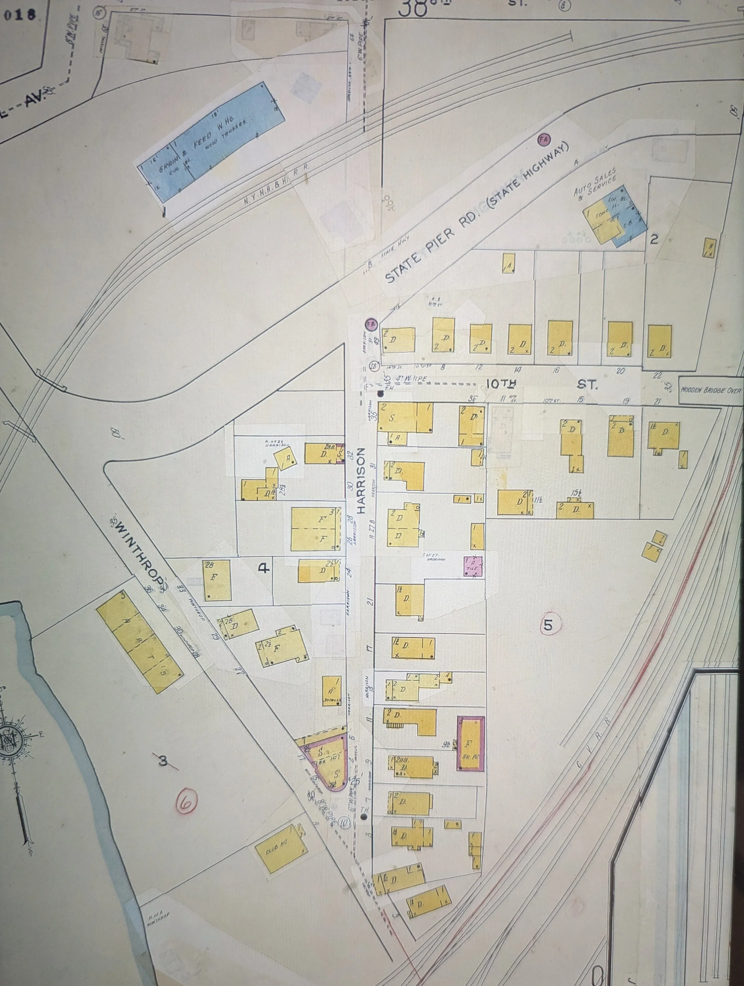

This is an enlargement of the Sanborn map from 1951. You can see the patched changes since 1921.
Below the intersection with State Pier Road, the corner area is vacant… do you know why? (hint: that corner is still vacant and most likely always will be)
The large rectangular outline on the cove side of lower Winthrop Street was a frame apartment house, 3-story, four sections, 12 apartments in all. Up until redevelopment, the apartments were largely occupied. The street numbers are 36, 34, 30, and 28 Winthrop Street.
Opposite stand three houses: 33, the Charles Barscz house, 29, the Anton M. Siderewicz house, and 27, a three-family house. More on these people and their homes later.
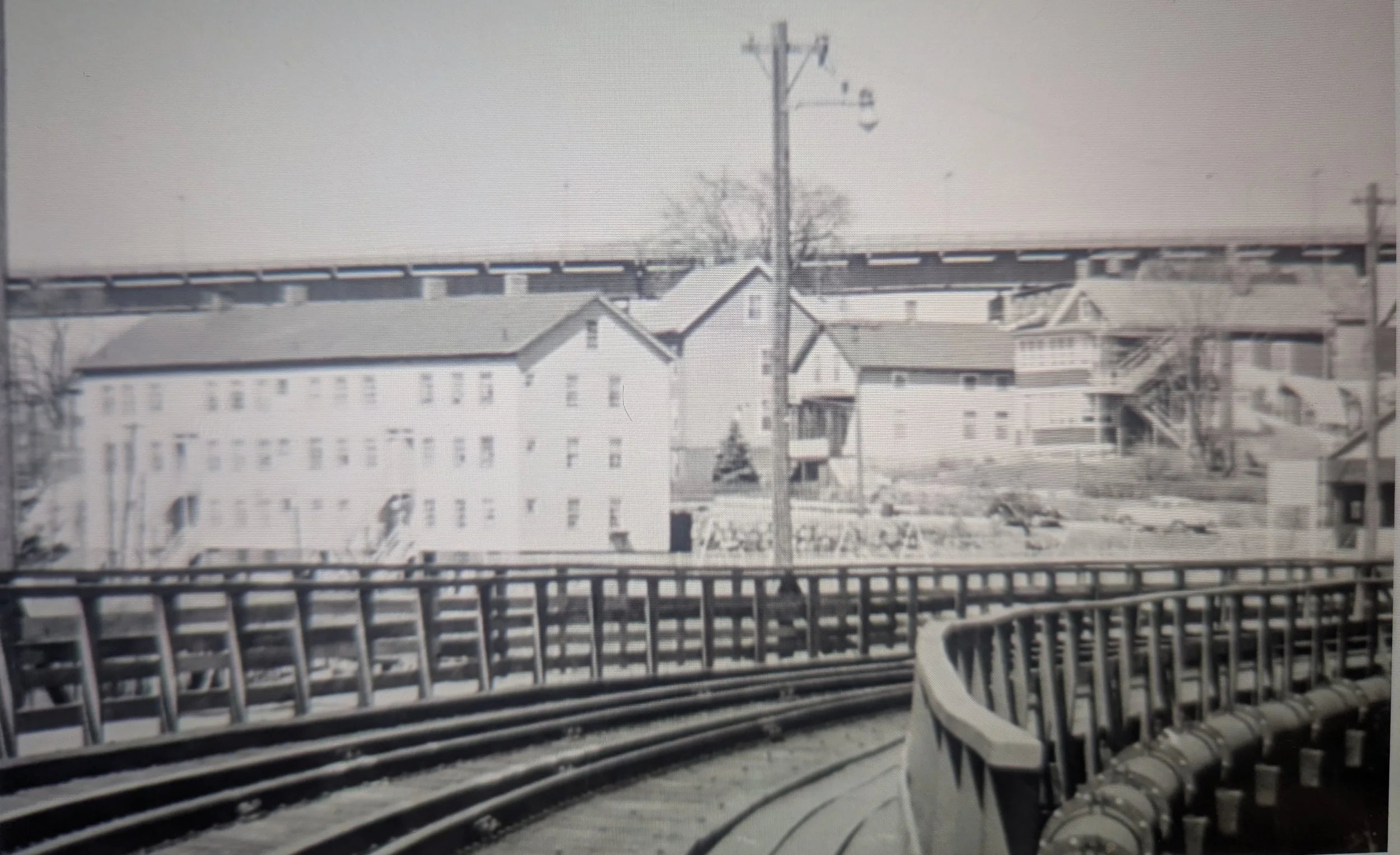
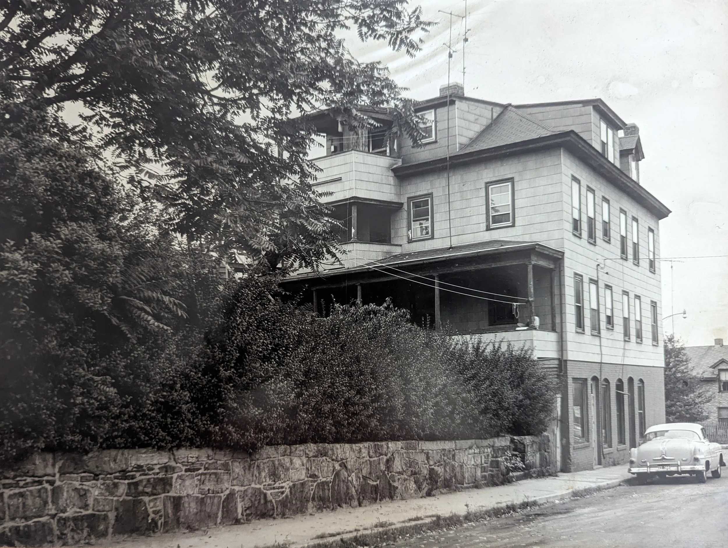
Here they are in a group shot taken from the Central Vermont footbridge, around 1960 or so. The Gold Star Memorial bridge, built in 1940-41, dominates the landscape.
Note the 4 chimneys atop 28-36 Winthrop, the laundry drying in the wind from 27 and the simple yet sturdy aspects of 29 and 33.
As far as I know, the sidewalk, stone retaining wall and steps going up are still there.
credit UCONN Archives
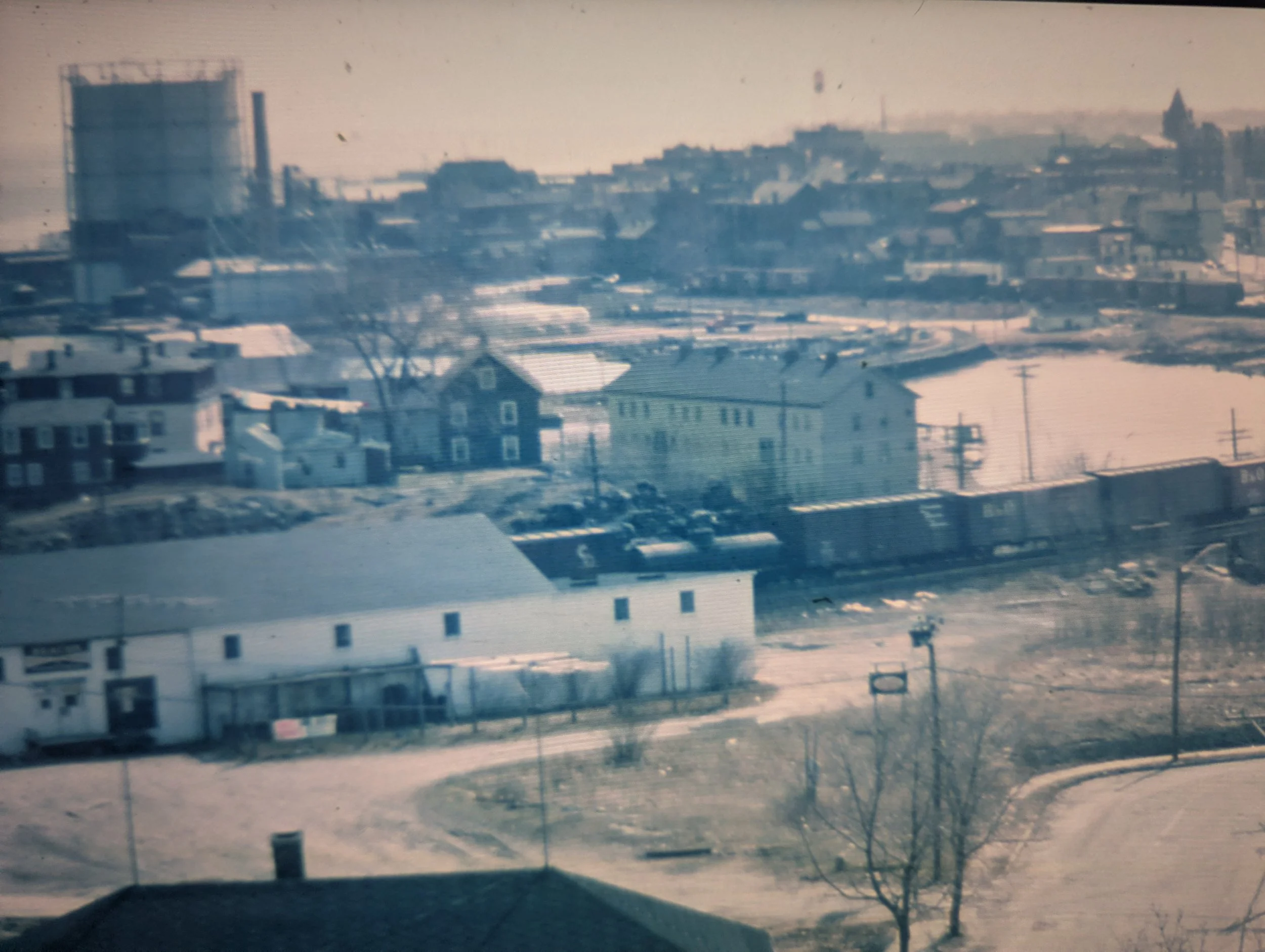
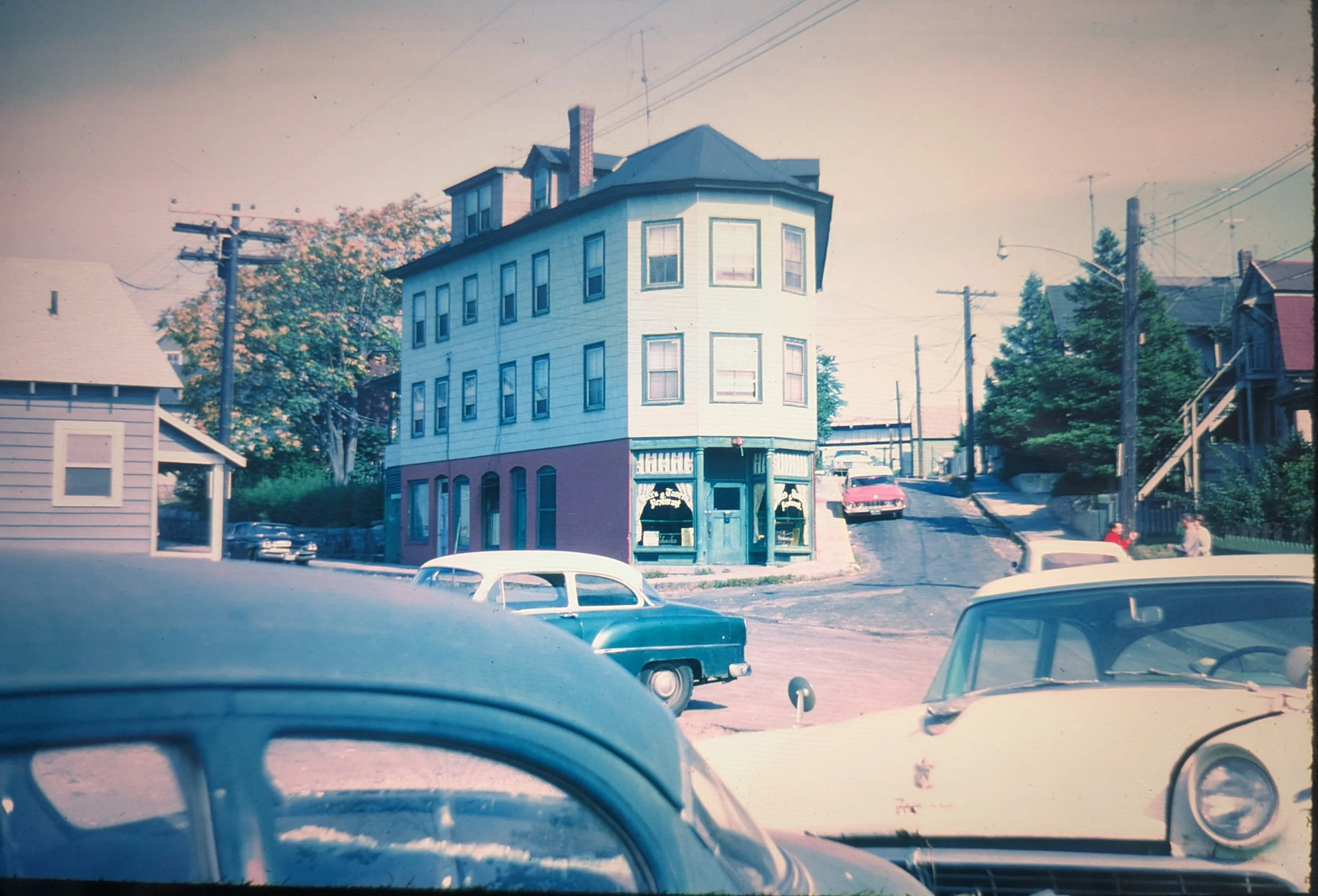
The same building group looking south from the bridge, courtesy George Oldershaw, 1961. The Crystal Avenue bend is in the lower right. The long white single story building is the New London Grain Co., both rail and truck served. Long freights snaking through town were the rule until the Penn Central started rerouting through freight traffic over the old Boston & Albany line. Above the left-most chimney of 28-36 Winthrop, you can just make out the New Haven caboose at the end.
The cupola with its eight windows allowed freight brakemen and conductors a 360 view of the train ahead and the scene around them. Many a caboose came equipped with a desk and chair for paperwork, personal lockers, a stove for cooking and heating (note the chimney pipe), a small fridge, a bunk for snoozing, a first-aid kit, and flares and torpedoes (small explosives triggered by wheels on rails as a warning to the engineer) for emergencies.
Around 1980, the caboose started to become obsolete with the introduction of a coupler mounted train brake/connection monitoring device called a FRED.
Freight trains went from a crew of 4-5 to a crew of 2.
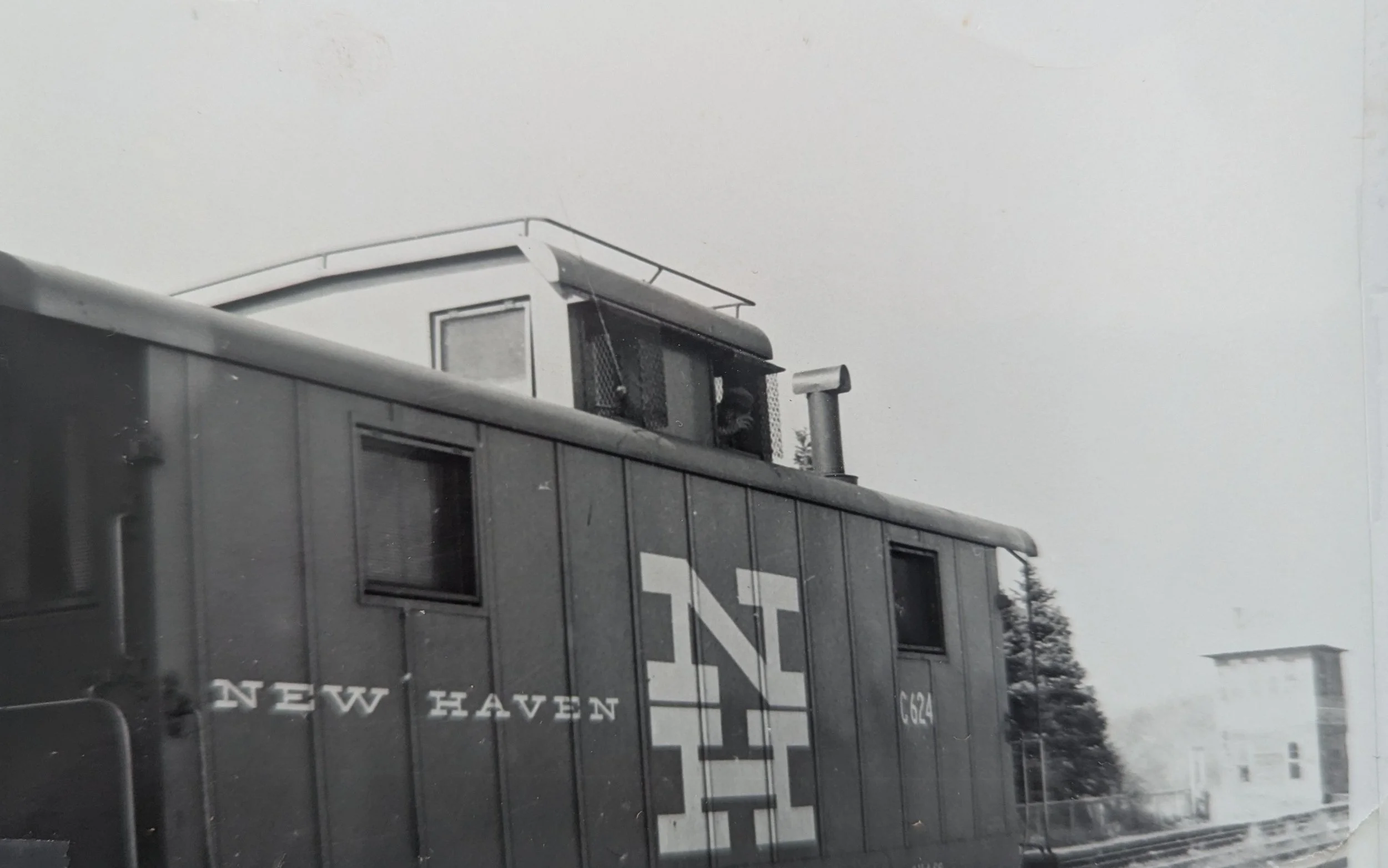
C624 on the New Haven… photographer, date, location, conductor (rear window) unknown
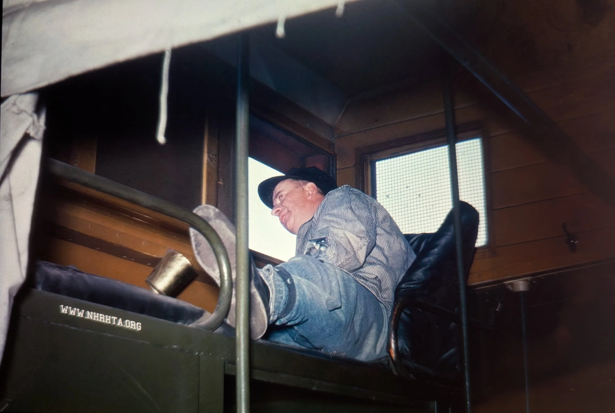
Inside the cupola of a caboose. Notice the rubberized cloth band near the bottom of the brakeman‘s jeans. These bands kept loose jeans in check and out of the way. Courtesy the New Haven Railroad Historical & Technical Assn.
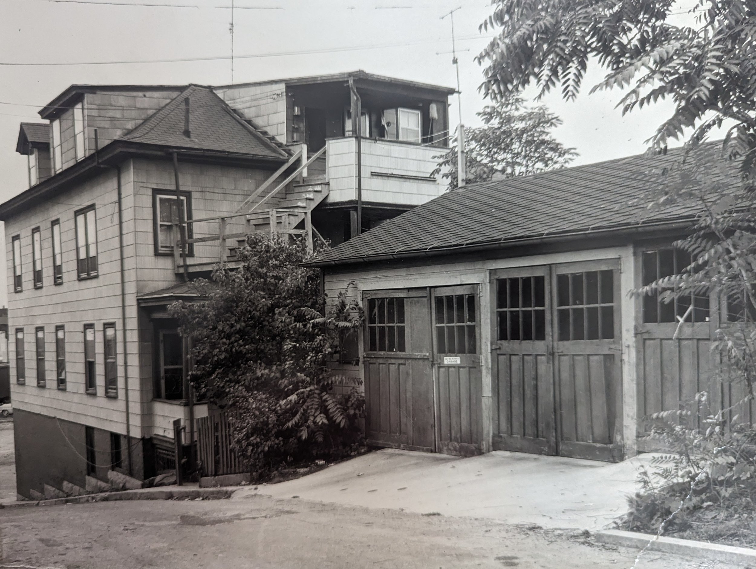
The Winthrop Street side of Max’s Tavern, looking south.
CONL, 1964
The V-form meeting of Winthrop and Harrison Streets as seen coming off the Central Vermont footbridge.
George Oldershaw 1961
to be continued…
The Harrison Street side.
CONL, 1964