the railroad earth of Lost New London…
On this page we will be carried through that portal to the beyond on what is called the railroad. We‘ll briefly look at it‘s slow development along the Thames River through the back-breaking pick and shovel work of immigrant hands, the pull of horse and wagon through mud, ice and snow, and the early, sometimes lethal days of steam power that carved and piled from God‘s green earth the graceful curves, the engineered, surveyed grades and embankments that made this newest means of transport the most comfortable, affordable, and quickest way of getting from A to B somewhere over the horizon.
This is not Jack Kerouac’s Canuck-powered mill town of Lowell, nor the alley of San Francisco‘s underbelly (today Candlestick Park) with it’s errant seagulls from the landfill next door, the dull thump-thump-thump over jointed rail on rotten ties, couplers bashing, wheels squealing, whistles screeching, men cursing and steam hissing… (though it could be). This was the noisy, tired end of Fourth Street, of Tenth, John and Douglass, the dirty backside of Harrison, Potter and North Bank. And while there was little of the beat poet’s running narrative put to paper, there was running life put to pavement, played out in the streets and along the tracks of Lost New London.
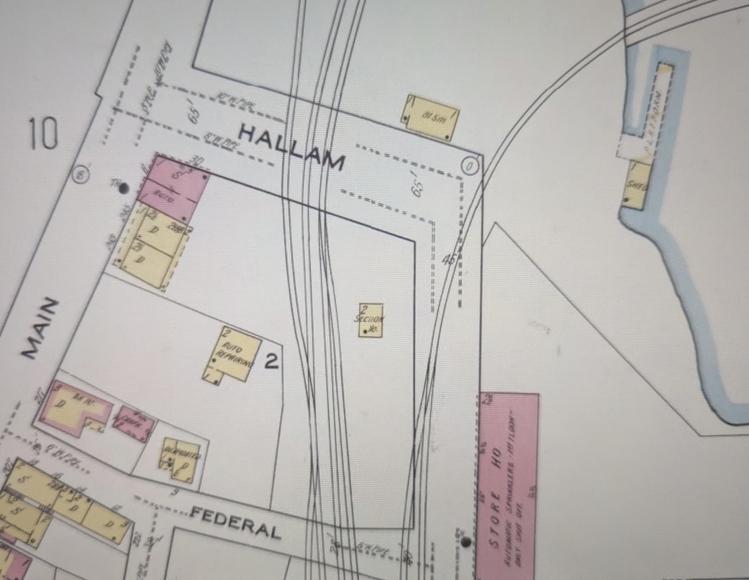
We‘ll start out with the known, the 1954 Sanborn map view of the Hallam Street area where the two railroads shook hands down by the Ferry Landing on lower Winthrop Cove at the bottom of Hallam Street.
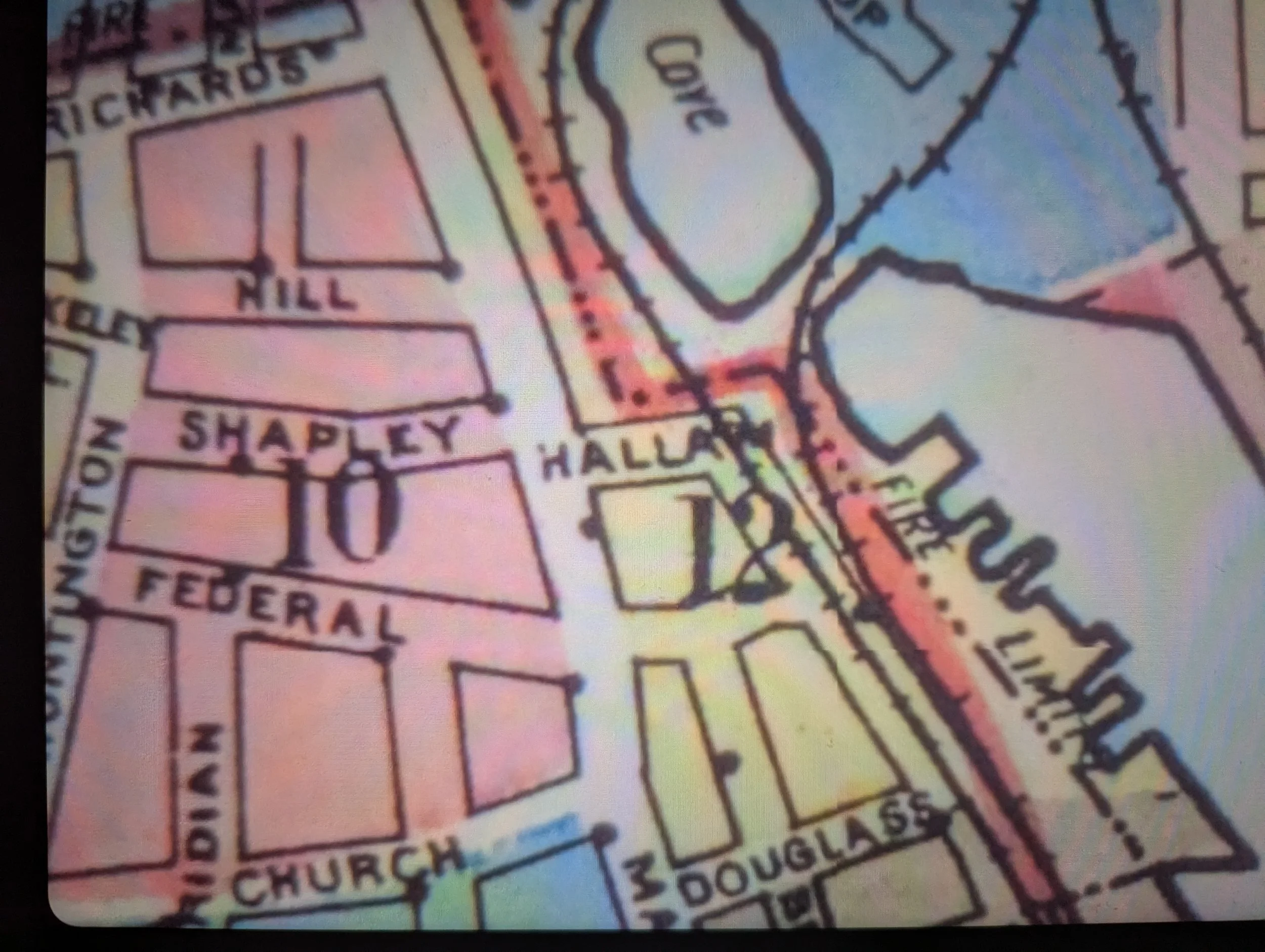
Above is the area per Sanborn with the New Haven and Central Vermont shown in 1954. Today these lines are still in service, though significantly reduced.
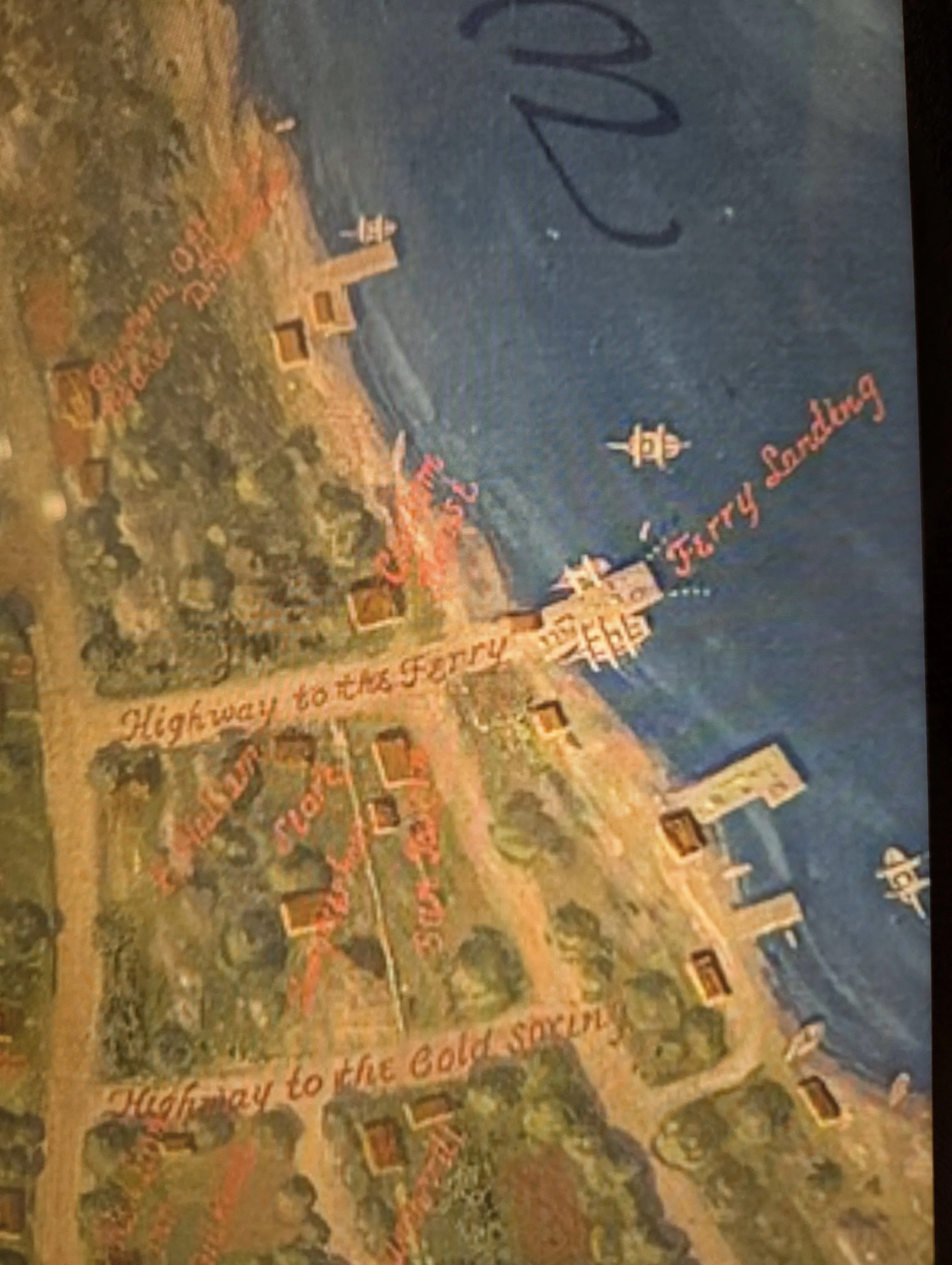
Above is the same area in 1761. Hallam Street is the Highway to the Ferry and Federal Street the Highway to the Cold Spring. A sailing vessel will, weather permitting, bring you, your horse and wagon across the Thames River to Groton on the opposite shore. Hallam‘s Sun Tavern will help you forget the experience. Courtesy N.L. City Hall
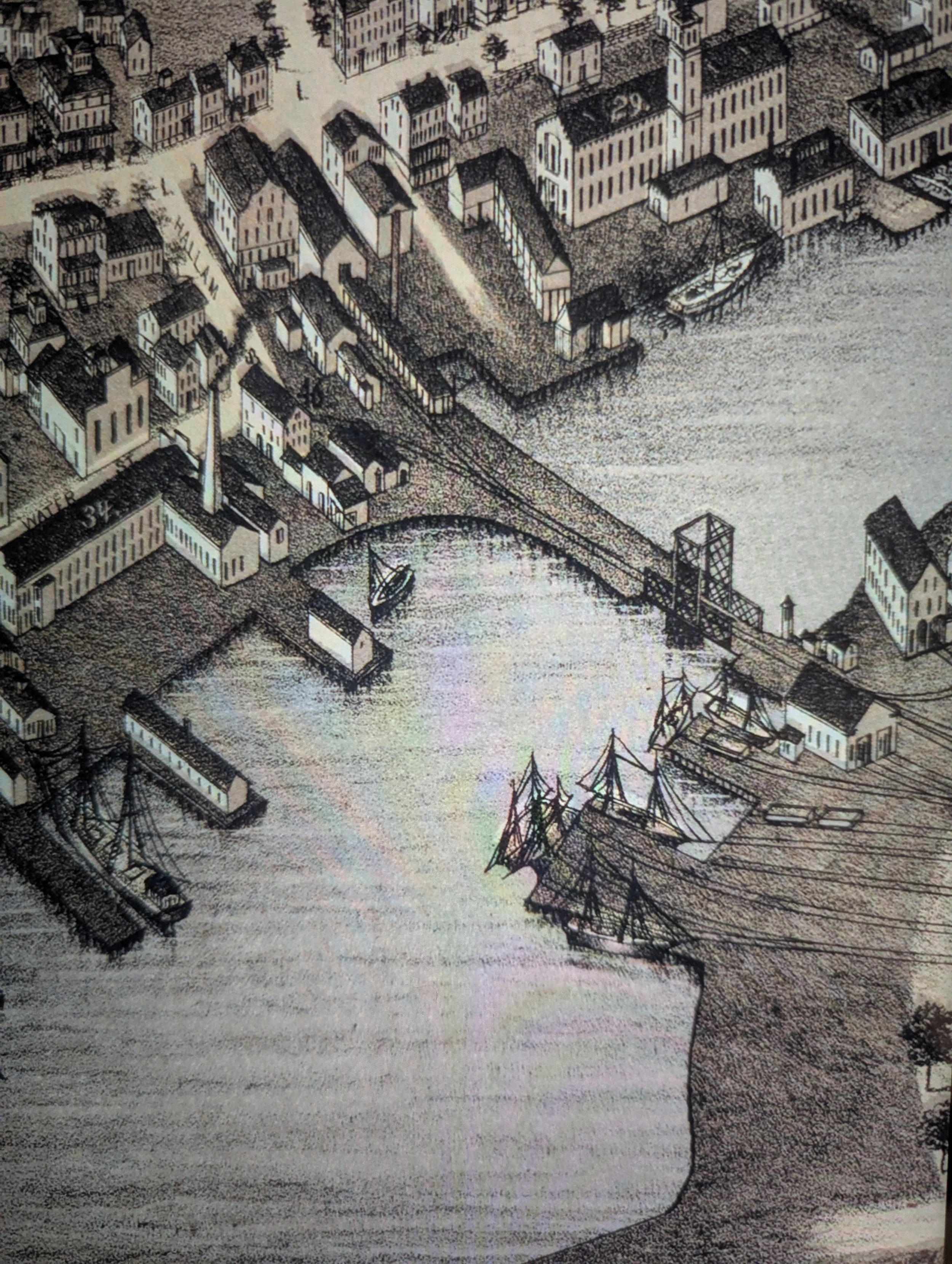
Fast forward a hundred years or so to 1876. Main Street runs north and south in the upper left-hand corner. The Albertson and Douglass Machine Company with its central stair tower is marked with a 29. New London Woolen Mills with smoke rising from its tapered smokestack is at 34., and it’s neighbor to the right, at the bottom of Hallam Street, is Chappell Wood & Coal marked with a 46.
The New London Northern Railroad swing bridge links Winthrop Neck with the rest of the city and the Shore Line Railroad which runs to New Haven and points west. Water freight and passenger traffic are still important, but the owners of these sailing vessels are already finding their revenues plummeting as the railroads and the use of steam engines continues to expand.
Courtesy the Library of Congress
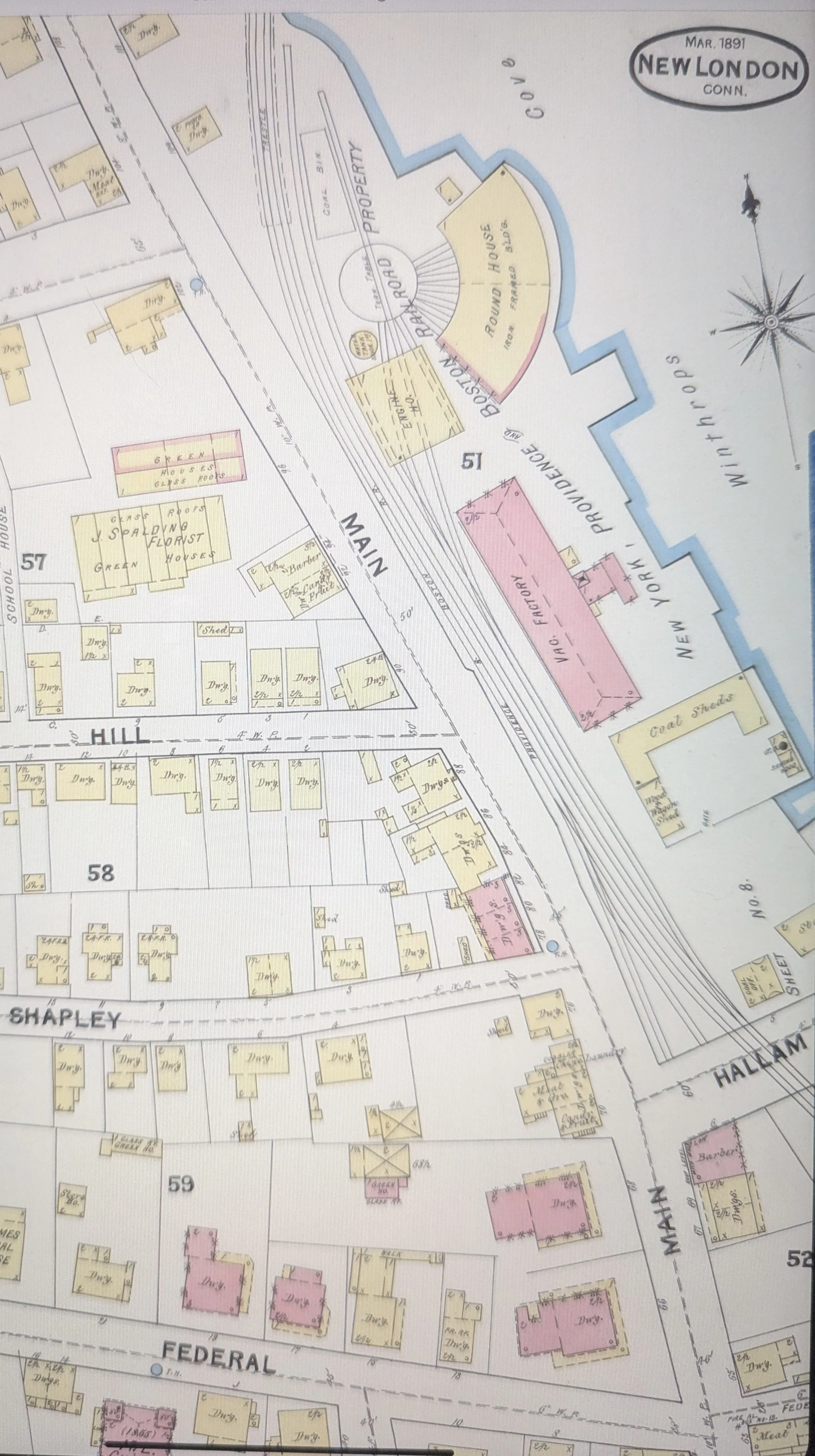
Around 1889, the New York, Providence & Boston (successor to the Shore Line) completed work on the Thames River drawbridge thus making an all-rail route possible from New York to Boston. Steamships offered this service earlier through over night trips.
This was now changing. Notice the Albertson & Douglass Machine Co. is marked vacant factory. Sanborn map date is 1891.
Courtesy the Library of Congress
By 1901 the New Haven had taken control of the NY, P&B while the Central Vermont had bought out the New London Northern.
The 4 tracks as shown above are as follows, left to right: Hallam Yard lead track (by now the roundhouse and turntable were gone), the New York bound main, the Boston bound main, the connecting track with the Central Vermont.
Notice that by 1921, this immediate area was no longer built up. Can you guess why?
the Central Vermont Railway (gateway to Montreal)
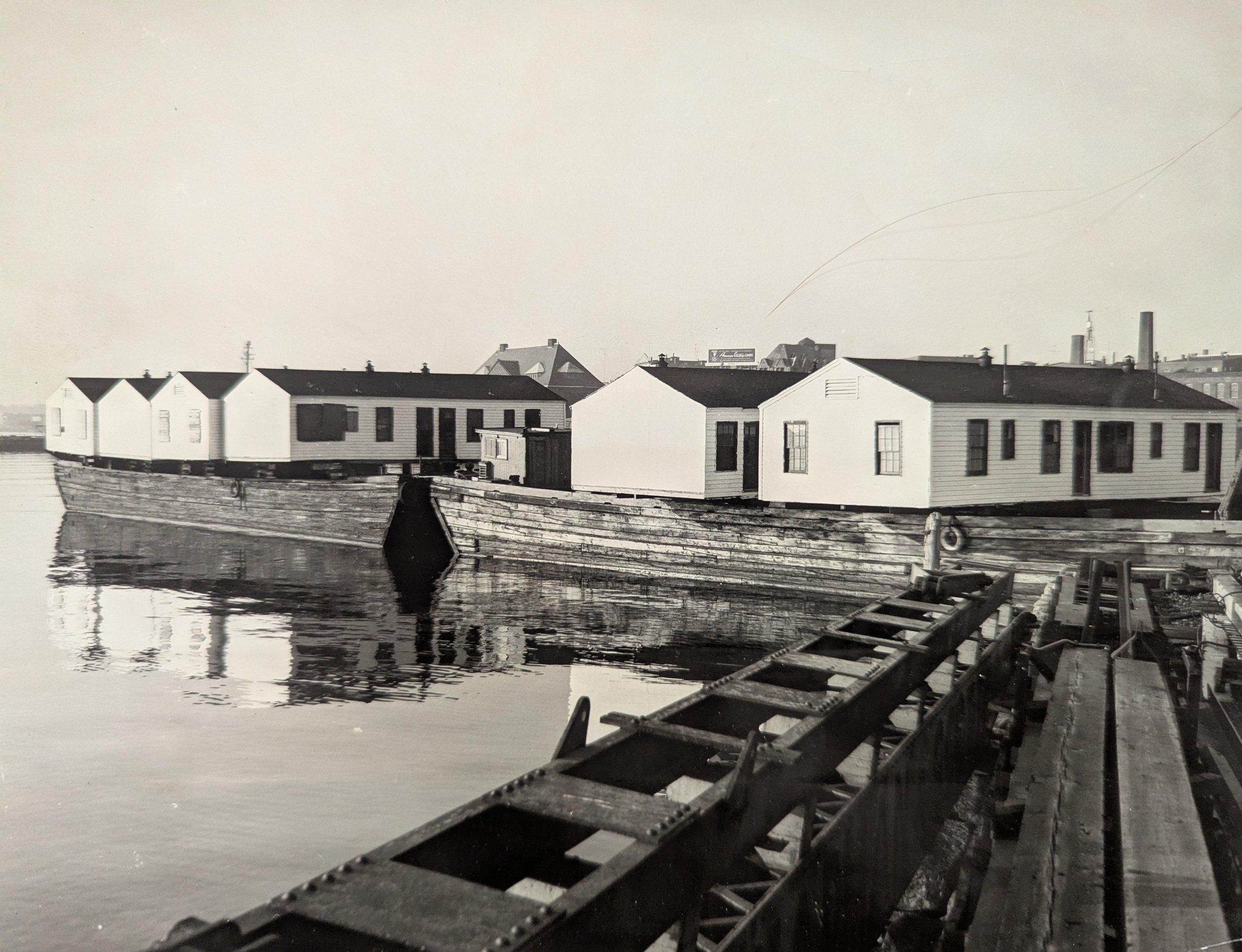

In 1950, a chicken farmer in Colchester ordered outbuildings to house the workers. The buildings arrived by two barges that were left tied up at the end of the CV pier, left of the 47 shown on the map. State Pier is on the right. A Day photographer took this picture while the farmer quickly made arrangements in seeking approval to finish the move by land.
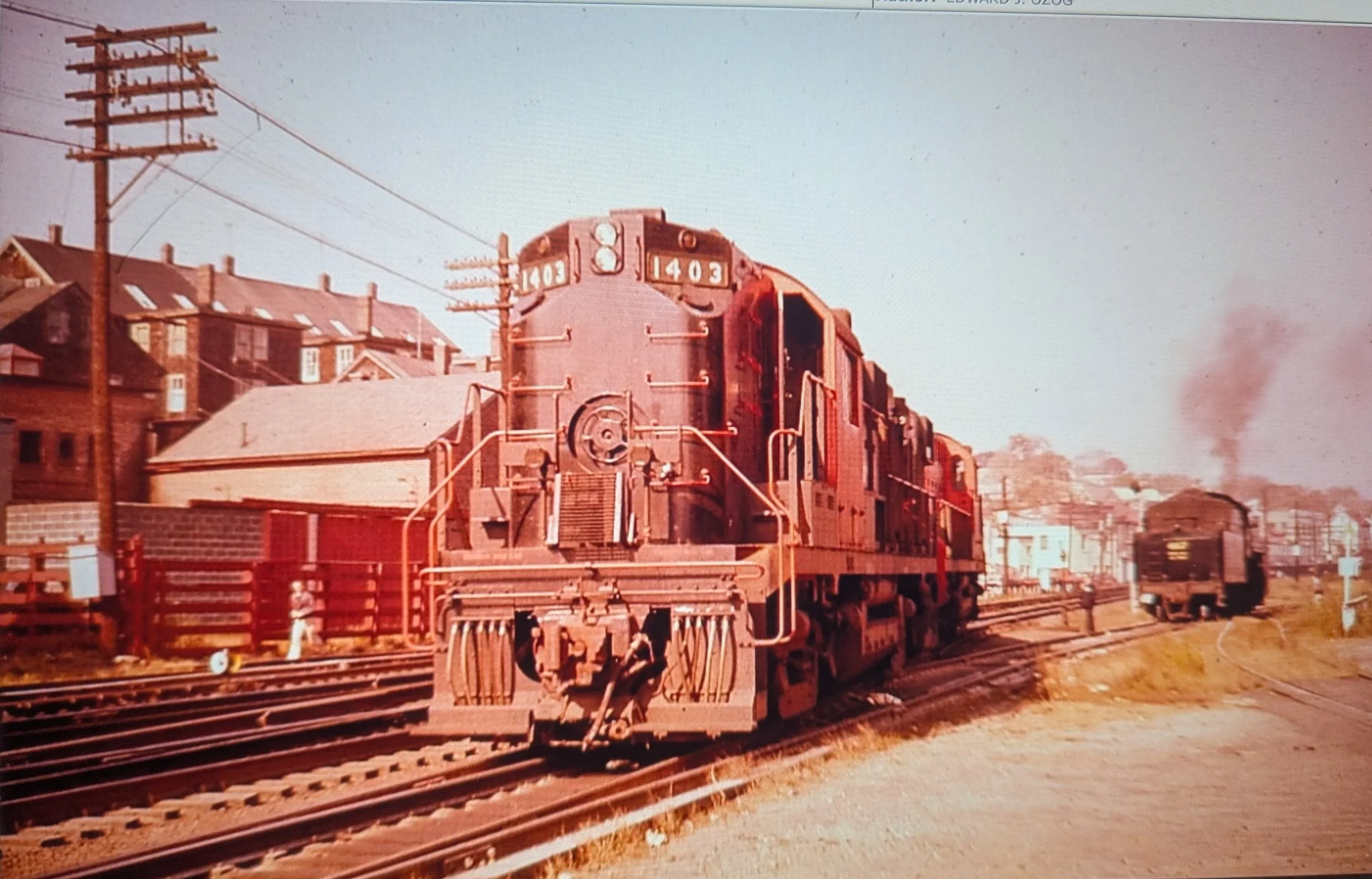
The date is April 15, 1957. Two railroads are meeting to exchange cars, the New Haven in the foreground, the Central Vermont in the background. We‘re in the last months of steam. on the CV as evidenced by #467, a 2-8-0 (2 pilot wheels, 8 driving wheels, no trailing (training ha!) wheels). The NH ran it‘s last steamer 4 years earlier. We are looking at an Alco RS11 in McGinnis orange and black livery.
Where are we? The Soltz block of 15 apartments at the corner of North Bank and Douglass is on the left hand side, note the five chimneys profiled against the light blue sky. The red stockade fence trackside was to hold animals delivered by the NH to the Freeman Bros. meat market located at the bottom of Douglass Street.
Looking down the line past #467 on the right, you can just make out the trackside retaining wall and the white squarish masonry building of Whaling City Ford. Richards Street separates the dealership from the white 2 1/2 story gabled house where Zeke‘s package store is located.
Courtesy Edward J. Ozog and RRPictureArchives.NET.
And this is where our intro to Lost New London‘s railroad earth ends. Please go back to the home page menu and click on the Central Vermont and New Haven pages for more of the Lost New London railroad experience. As always, I invite your comments, corrections, and contributions. They are most welcome!
thank you,
Bill
lostnewlondon@gmail.com